Trekking Conditions
What is the Weather Like on Kilimanjaro?
The main weather conditions that can cause concerns while climbing Kilimanjaro relate to cold temperature and precipitation. Though the average temperatures on the lowlands of Tanzania are relatively warm and stable throughout the year, the temperature on Kilimanjaro varies widely depending primarily on the altitude.
The dry seasons of mid-June through October and December through the beginning of March are the best times to climb. But even during the “dry” seasons, climbers may still experience heavy rains. The mountain’s weather is unpredictable and climbers should be ready for wet and cold conditions no matter when they come.
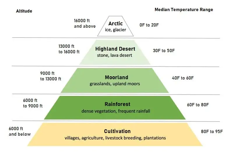
There are distinct climatic zones on different altitudes with changing vegetation. We will pass through five major ecological zones on the way to the summit. As we gain altitude, the temperatures drop as does precipitation levels and vegetation. While the temperatures in the rainforest are generally very mild, averaging 70 degrees Fahrenheit, the temperatures during the night ascent to the summit can be below zero. Therefore, climbers need to have the appropriate extreme cold weather gear to endure harsh winter weather for many hours.
Cultivation Zone
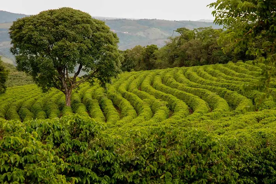
Zone 1 is known as the Cultivated zone it is approximately 2,600 ft to almost – 6,000 ft (800m – 1800m).
This region of the mountain receives the greatest annual rainfall. It also has many rivers formed by glacier run-off from the top of Kilimanjaro. This zone is made up of farmland and small Chagga villages. These villages are where many of the porters and guides you will see on the mountain come from. You will drive through these villages on the way to your climb.
The farmland in this region is mostly used for coffee production. Some of Africa’s best coffee comes from the foothills of Mount Kilimanjaro. Bananas, avocado, mango and other fruits are also grown on the lower mountain. You will walk through fields of them if your trek exits through Mweka Gate.
Rainforest Zone
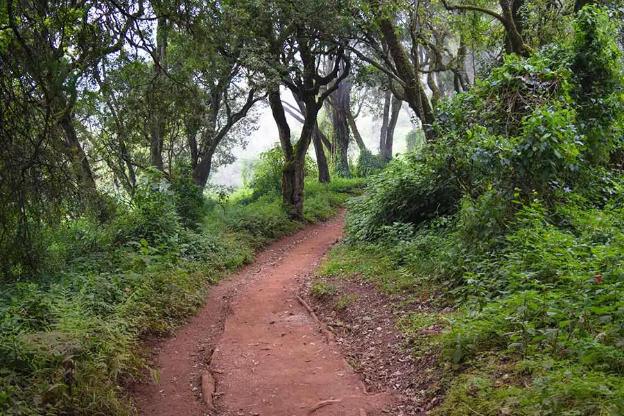 Zone 2 is known as the Forest or Rainforest zone it ranges in elevation from 6,000 ft to just over 9,000 ft. (1800m – 2800m).
This rainforest circles a majority of Mount Kilimanjaro. However, most of the rain on the mountain falls on the south and the east side. The forest is much thicker here than to the north on the Kenyan side of the mountain. The flora and fauna are diverse but the animals are very elusive. Monkeys (both Blue and Colobus) are prevalent on certain routes and while olive baboons, leopards, mongooses, elephants, bushbabies, black rhinoceros, giraffes and buffaloes are known to visit the mountain’s slopes they are rarely seen. If you do see some good wildlife take lots of pictures, you’ll be one of the few people who have! The best places to see wildlife are just above the thinner jungle on the Rongai Route and on the edges of the Shira Plateau.
The rainforest jungle is simply amazing. The colors seem more vibrant than any forest you have ever seen. The trail is flanked by deep gorges of emerald blankets of every shade of green imaginable. Rising majestically out of the forest floor are twisted, ancient trees draped in coats of moss. When there is a break in the foliage, you get views of the clouds weaving their way through the tree tops. The temperatures in the forest are usually mild and if it’s going to rain on your climb, it will be here.
Heather and Moorland Zone
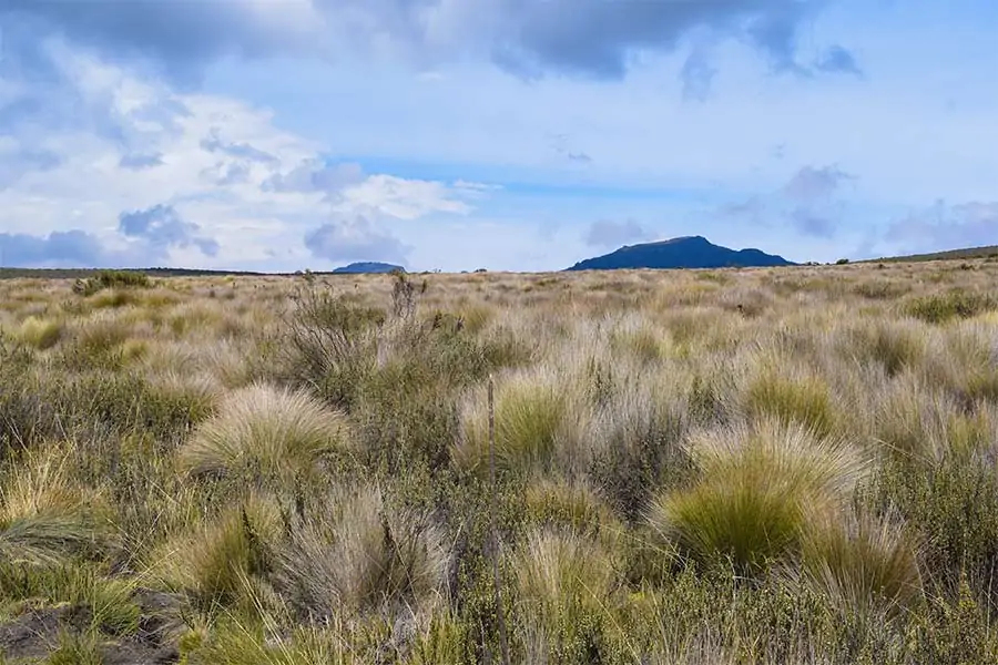 Zone 3 begins with the Heather zone and ends with the Moorland zone. The elevation starts around 9,000 ft and tops out around 13,000 ft. (2800m – 4000m)
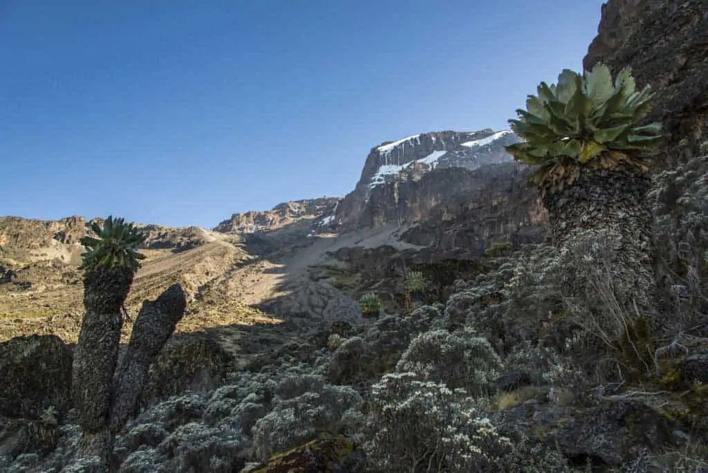
The rainforest quickly gives way to the Heather zone. The temperatures here are erratic. The daytime temperature can soar above 100° F (40oC) yet drop below freezing (32° For 0° C) at night. These temperatures combined with less rain, gusting winds, giant heathers, wild grasses and a rocky trail replaces the rainforest very quickly. Some of the heather shrubs can grow to over 30 ft. high. As you climb tall grasses replace the heather as you enter into the Moorland zone. Large fields of wild flower cover sections of the mountain and you will often see clouds floating at your eye level. Expect amazing blue skies at the upper end of this zone. There will be little cloud cover to protect you from the sun’s UV rays. Brings lots of sunscreen.
Now that you are above the cloud line the views of the rainforest below and the top of Kilimanjaro 7,000 ft above are simply breathtaking. Once the sun sets, the stars are overflowing in the night skies and create a truly peaceful environment.
Highland Desert Zone
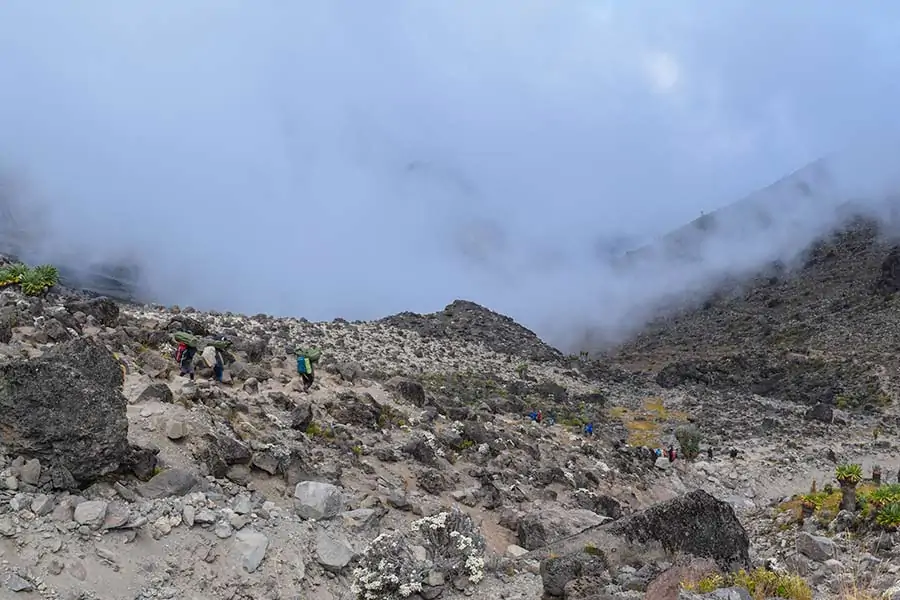 Zone 4 is known as the Highland Desert zone it’s elevation begins around 13,000 ft. and continues up to 16,000 ft. (4000m – 5000m).
This region of the mountain is a strange place, truly deserving the title of Desert. The annual rainfall is less than 8 inches a year and what plant life exists at this altitude has to put up with the oppressive sun and sub-zero temperatures—all in the same day. This area also shows off its violent past with fields of volcanic rock of all shapes and sizes. You are now close enough to the cone of Kibo to see the vast glaciers that cling precariously to its steep ledges. It has deep gorges on the slopes and breaches in the crater rim where molten lava blasted through during prehistoric eruptions. The landscape is barren and stranger than anything you may have seen before.
Make sure to bundle up at night. at this altitude, the mercury dips well below freezing and you may wake up to frost on the ground in the morning.
Arctic Zone
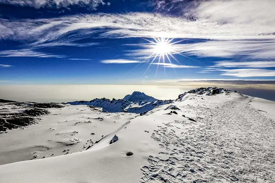 Zone 5 is known as the Arctic zone. The elevation begins around 16,000 ft. and continues to the top of Uhuru Peak at 19,341 ft. (5000m – 5895m).
With very little rainfall (most precipitation falls as snow) this barren desert is characterized by huge rocky outcrops, volcanic scree, and glaciers. The elevation at this zone is known as “extreme altitude,” with approximately half the oxygen at sea level. It is a bleak, inhospitable place.
As expected, the weather here is very cold, with blustery winds and nighttime temperatures well below freezing. As you set off for your summit attempt, there may be ice and snow underfoot. Even at midday and the sun’s radiation is harsh.
The lower section of this zone is made up of rock, loose dirt, and gravel known as scree. Scree is quite difficult to climb. That is part of the reason the summit attempt begins at night when the evening dew has settled and frozen. This allows the scree to knit together making it a more stable path.
As you climb, ice will begin to appear in patches and grows as you approach the lower reaches of the ice fields and glaciers. The traditional summit route takes you up to the rim of the volcano at Stella Point then heads west for one last push.
What Do I Need to Do on the Mountain?
Our Kilimanjaro climbs are fully supported. You will have the services of a lead guide, assistant guides, a cook and a number of porters. These personnel will handle all of the labor in and around camp to make your trip as comfortable as possible. They will take down and set up your tents, prepare hot meals, wash dishes, boil water, and transport all of the communal equipment as well as most of your personal gear. You are not expected to do any chores around camp. Just relax, recover and enjoy yourself.
All you need to do is hike from camp to camp with a medium-sized daypack (about 30L). Inside your daypack, you will carry what you may need during the day. Typically, this means extra layers of clothing, snacks, and personal use items such as sunscreen. The daypack will normally weigh 10 to 20 pounds, including water.
Our porters will carry all of your other gear in a duffel bag between campsites. This includes your sleeping bag, clothing you will not use during the day, and recreational items like books. Note that the weight of your duffel bag, including the sleeping bag, is strictly limited to 33 pounds.
You will be responsible for packing your daypack and duffel bag every morning, prior to breakfast.
What we do ask of our clients is that they be proactive about their health and safety on the mountain. Many of these things are common sense but we have noticed that some clients feel uneasy about “causing a fuss” in the presence of others. We would like to emphasize that our staff is there for you and you should not hesitate to ask for their assistance.
Here are some simple tips to increase our chances of a successful trip.
- Eat and drink as much as you can on a daily basis.
- Wash your hands frequently, before every meal and after using the bathroom.
- If you feel a blister coming, take action to fix it before it becomes a larger problem.
- Adjust your clothing as necessary. Limit your exposure to heat, cold, wind, rain and sun.
- Communicate any symptoms of altitude sickness to our guides as they develop.
What is the Daily Schedule on the Mountain?
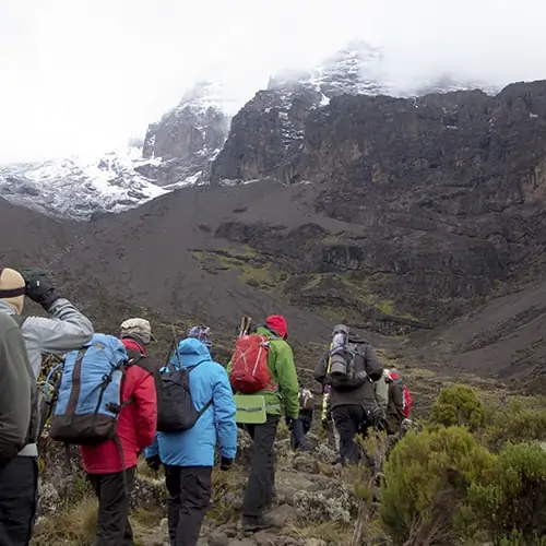
The day begins with a friendly wake up “call” from your waiter at about 6:30 AM. A pan of warm water with soap is provided for washing your hands and face. Hot drinks are available inside the dining tent or delivered to you inside your tent. Followed by breakfast. Porters will pack up your tent and belongs while you eat. So once you get up, dress and pack quickly. At this time you also fill up your water bottles and bladders. Our guides will take conduct health checks before you begin hiking, around 8:00 AM.
You will notice that the guides set a deliberately slow pace (“pole pole”, or “slowly, slowly”) in order to give clients adequate time to adapt to the thinning air. Approximately every hour, we will take a rest break to eat some snacks, drink water and adjust your clothing if necessary. Our guides will continuously monitor your performance to assess the effect of the altitude, energy expended and everything else that may affect you. Normally, you are on the trail until midafternoon, including a longer lunch stop.
The daily hikes are not very strenuous. For the most part, the trails are very steady and safe. We walk on established routes at an easy pace and take several breaks. This light schedule is intentional, as it is the best way to gradually adapt to the altitude. This requires no technical skills. There are only very short sections that have exposure (drop-offs), but the risk of falling during the entire journey is almost zero. Our guides will direct you through difficult sections. Guides will accompany you the entire way to prevent you from getting lost.
While you are hiking, the porters move ahead of the trekking party in order to set up camp, prepare food and collect water so that everything is ready when the group arrives. We will serve you snacks. Then, before dinner, a pan of water is again provided for clean up. After dinner, our guides will enter the dining tent to conduct another round of health checks. It is important to communicate any symptoms of altitude sickness if you have them so that the guides can decide how to best treat you. To end the evening, the lead guide will explain the itinerary for the following day. Most people retire at about 9:00 PM.
What is the Schedule on Summit Day?
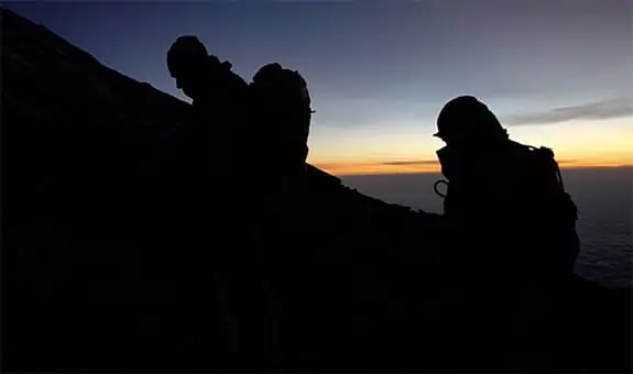 The summit “day” climb actually starts the night before. After an early dinner and bedtime, the climbers are woken up before midnight. This is where you will likely be dressed with four layers on top and two or three layers on the bottom, as conditions are typically very cold at this altitude and hour. Your day pack will be the lightest it has been during the trip – carrying only the bare essentials. The ascent takes between 6-8 hours. We will take breaks along the way to allow climbers to get much-needed rest while at the same time being cognizant not to sit too long because it is cold. Our guides will be especially observant as this extreme altitude can be problematic for some people. If necessary, our guides will separate the group into smaller groups based on their walking speed. If anyone cannot continue climbing, he or she will be taken down by one of the guides to the campsite to rest and recover. Because we have a 1:2 guide to client ratio, you will never be required to turn around because another climber has to stop climbing.
After several hours, you will reach Stella Point. There is a sign visible from several meters away, you’ll want to focus on it despite your burning legs and light-headedness. Don’t worry, it is easier after this push. Once you reach Stella Point. you can take a break and take in the stunning views. You are standing on the edge of the crater and have 360° views of the mountain, Mt. Mawenzi, Mt. Meru and the rainforest clouds below you. From here you only have 40-60 minutes left to the summit. The trail is much more gradual from this point on. You will pass by the majestic Southern Icefields and will have amazing views of the glaciers.
A wooden signboard marking the top stands at Uhuru Peak. On most days there is a short line of people waiting to take photos. Once the sun rises, the temperature becomes much warmer and you will likely remove some layers and apply sunscreen for the descent. At high camp, we spend some time resting and eating before packing up our belongings and continuing our hike off the mountain. This long descent is the hardest part of the climb.

